Lord Howe Island, New South Wales, Australia

AWARDS_LGE+AUSTRALIA.jpg

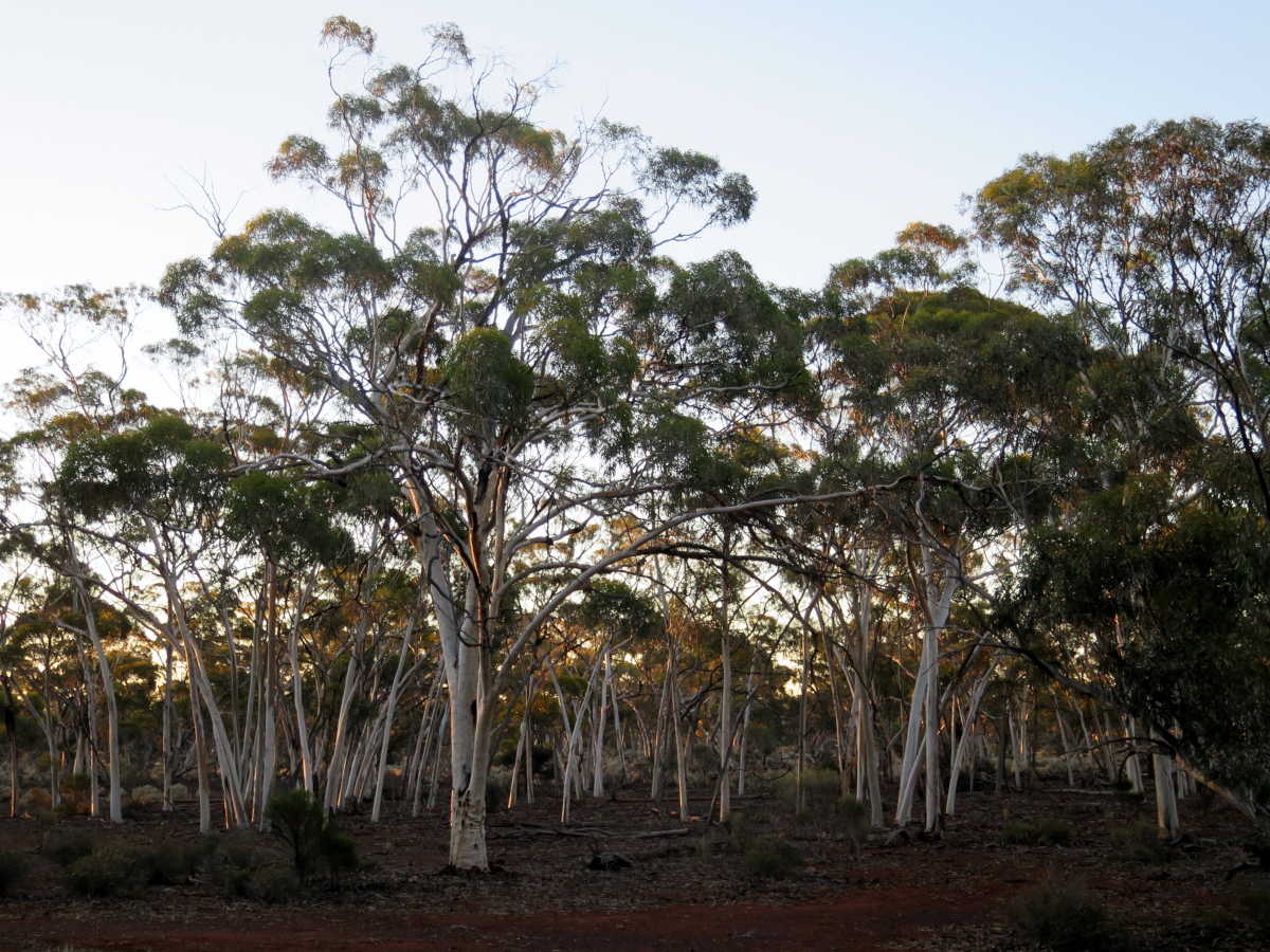
Since the 1980s the Lord Howe Island (LHI) Board  has been conducting a holistic ecological restoration program, focusing on countering the effects of introduced and invasive species that threatened the island’s World Heritage recognised ecosystems. The conservation and invasive species eradication programs are island scale (1455ha) and have resulted in change and a demonstration that a community can turn back the tide on environmental degradation and invasive species impacts with determination and sound ecological guidance.


Key strategies include the management and eradication of invasive weeds, rodents, tramp ants and protection from plant diseases and pathogens on the recognition that failure to act would result in further impact and decline of species and their habitats.  Achievements include the successful eradication of over 10 weed species, cat, pig, goat, African Big-headed Ant and myrtle rust. A further 20+ weeds are considered on the verge of being able to be declared eradicated in coming years with an 80% reduction in weed density island wide and a 90% reduction in the presence of mature weeds. An eradication program for ship rat, house mouse and the introduced masked owl are scheduled for winter 2019 following final approval by the LHI Board in September 2018.


All projects within the program are based on proven ecological restoration principles and trialled on site. Each project has relied on input from experts in their relevant field and key partners. Projects are implemented in accordance with adopted work plans and are work to factor in community issues and concerns without affecting the project outcome. Most projects have utilised volunteer and expert contract input from the mainland and other island eradication projects, such as those carried out in New Zealand).

The program’s significant outcomes have been recognised through the IUCN Conservation Outlook which in 2017 scored the Lord Howe Island Group’s outlook as good, primarily due to the success of projects that have, are being and are  planned to be implemented to restore and protect the islands unique World Heritage values.

Weed teams apply search effort across near 80% of island terrain, their effort monitored through record of GPS track logs across designated weed management blocks.

Weed teams apply search effort across near 80% of island terrain, their effort monitored through record of GPS track logs across designated weed management blocks.

Contact: Hank Bower, Manager Environment/World Heritage, Lord Howe Island Board, PO Box 5, LORD HOWE ISLAND, NSW 2898, Ph: 02 65632066 (ext 23), Fax: 02 65632127, hank.bower@lhib.nsw.gov.au

Links:

Read the EMR Project summary: https://site.emrprojectsummaries.org/2018/12/20/lord-howe-island-biodiversity-restoration-and-protection-programs-nsw-australia/

Video conference presentation: https://www.aabr.org.au/portfolio-items/protecting-paradise-restoring-the-flora-and-fauna-of-world-heritage-listed-lord-howe-island-hank-bower-and-sue-bower-lhi-board-aabr-forum-2016/

Long Swamp, Discovery Bay Coastal Park, Victoria, Australia

AWARDS_LGE+AUSTRALIA.jpg

Long Swamp is a 15 km long coastal freshwater wetland complex situated in Discovery Bay Coastal Park, approximately 50 km north-west from Portland in south-western Victoria. The wetland system supports a diverse suite of nationally threatened species and is now part of Australia’s 66th and newest Ramsar site (Glenelg Estuary and Discovery Bay) and is recognised as a wetland of international importance.

The restoration project began after the local community in Nelson, Victoria, had expressed concern for over a decade about the impact that two artificial outlets to the ocean were having on wetland condition. The outlets were cut during an era when the swamp was grazed, many decades before being dedicated as a conservation reserve in the 1970s. In 2012, Nature Glenelg Trust (NGT) became actively involved in Long Swamp, working closely with Parks Victoria, the Nelson Coast Care Group, and the Glenelg Hopkins CMA. After a scientific review it was found that the more remote artificial outlet to the sea had in fact naturally closed (resulting in some natural recovery). A trial was subsequently planned to block the second and final artificial outlet to increase the availability, diversity and connectivity of aquatic habitats throughout Long Swamp, in order to benefit a wide range of wetland dependant species.

From 2014 to 2015 a temporary structure to block the outlet (made of 7000 sandbags) was completed, involving over 60 volunteers. Water levels in the swamp immediately upstream of the final structure increased, showing sustained recovery of key species and inundation extent. There have also been large gains across downstream habitats as a result of groundwater mounding, sub-surface seepage and redirected surface flows through several hundreds of hectares of wetland habitat. Meaningful community participation has been one of the most critical ingredients in the success of this project so far, leading to a strong sense of shared achievement for all involved. Monitoring continues to guide ongoing works, which now includes converting the trial structure to a permanent solution in 2019 – which will take the form of a reinstated, revegetated sand dune built around the trial structure.

Nature Glenelg Trust staff members celebrate the completion of the third and final sandbag structure with some of the many dedicated volunteers from the local community. (Photo Mark Bachmann)

Nature Glenelg Trust staff members celebrate the completion of the third and final sandbag structure with some of the many dedicated volunteers from the local community. (Photo Mark Bachmann)


Contact. Mark Bachmann, Nature Glenelg Trust, PO Box 2177, MT GAMBIER, SA 5290 Australia, Tel +61 8 8797 8181, Mob 0421 97 8181, Email: mark.bachmann@natureglenelg.org.au  Web: www.natureglenelg.org.au

Links

Longer outline on EMR journal’s project summaries website: https://site.emrprojectsummaries.org/2016/03/07/long-swamp-discovery-bay-coastal-park-victoria/

NGH newsletter in which there is a link to a video on the project: http://natureglenelg.org.au/ngt-wins-the-2018-sera-national-award-for-restoration-excellence/


Wompoo Gorge (south), New South Wales, Australia

AWARDS_SMALL+PROJECTS.jpg

Much of the state- and nationally listed Lowland Subtropical Rainforest at Wompoo Gorge, located on Coopers Creek near Rosebank, was partially cleared for pasture early last century. Parts of the cleared forest regenerated naturally with the removal of agricultural activities from the site during the 1940s-50s, but Lantana (Lantana camara) established in large gaps and prevented any further rainforest regeneration. This weed domination reduced the function of an important habitat linkage between Nightcap and Goonengerry National Parks. Twenty-seven threatened species (10 threatened flora species and 17 vulnerable animal species) have been recorded on the site, which has been identified as a key climate change and wildlife corridor.

In 2009 a program of ecological restoration commenced in the southern 40 ha of the 78 ha property. Works focused on systematic control of Lantana by a range of methods including: mechanical with a tractor; spraying, splattering and cut/scrape and paint to facilitate replacement of Lantana. Lantana has been virtually eliminated from extensive areas and vigorous regeneration of a high diversity of native rainforest species has occurred. The site has proved highly resilient, located as it is between two major sources of propagules. Its unique location, resilience and beauty has made it an ideal site to educate and inspire the community to restore rainforest. Involving Green Army participants alongside professional regenerators has helped Green Army participants gaining valuable knowledge, skills and training in ecological restoration. In 2014 NSW National Parks and Wildlife Service acquired the property realising the goal of former property owner Dailan Pugh to protect the property in perpetuity for the benefit of conserving native species and for future generations. Works are now ongoing in the northern part of Wompoo Gorge.

Caption to following photo: 2008-2015 Wompoo Gorge (south) restoration work areas and monitoring points (40ha)

Caption to following photo: 2008-2015 Wompoo Gorge (south) restoration work areas and monitoring points (40ha)

Contact: Paul O’Connor, Technical Manager, EnviTE Environment, 56 Carrington Street (P.O.Box 1124) Lismore  2480 Australia. Tel: +61 2 6627 2841 Mob: + 61 427 014 692. Email: paulo@envite.org.au .

See longer outline on EMR journal’s project summaries website: https://site.emrprojectsummaries.org/2015/05/30/wompoo-gorge-lowland-subtropical-rainforest-restoration-project-coopers-creek-new-south-wales/

Recovery of indigenous plants and animals in revegetated areas at 'The waterways', Victoria.

AWARDS_SMALL PROJECTS.jpg

"Waterways"; is a 48-hectare restoration project located on Mordialloc Creek in Melbourne’s south- eastern suburbs which combines a housing estate with large areas of restored habitat set aside for indigenous fauna and flora in open space, lakes and other wetlands.

Prior to restoration the land at Waterways was a property used for grazing horses and supported pasture dominated by exotic grasses. Restoration of the site commenced in October 2000. Extensive weed control and earthworks were carried out prior to the commencement of revegetation works, which involved planting, by 2003, over 2 million local provenance, indigenous plants.  Ongoing management of the site has included ecological burning and follow up weed control. When started the Waterways was the largest and most complex ecological restoration project ever undertaken in Victoria.

The habitats being restored at “The Waterways” reflect those that originally occurred in the Carrum Carrum Swamp, a vast wetland complex which, prior to being extensively drained in the 1870s, stretched from Mordialloc to Kananook and as far inland as Keysborough.  Local reference ecosystems were selected to act as a benchmark for what was to be achieved in each restored habitat in terms of species diversity and cover. Habitat Hectare assessments have been used to monitor the quality of restored vegetation.

A total of nine Ecological Vegetation Classes (EVCs, the standard unit of vegetation mapping in Victoria) are being re-established across the site across the following habitats;

  • Open water, Submerged Aquatic Herbfields and Exposed Mudflats

  • Densely vegetated marshes

  • Swamp Paperbark Shrubland

  • Tussock Grassland

  • River Red Gum Grassy Woodland

The habitats created in 2000 support over 220 indigenous plant species and have already attracted a vast array of native fauna. Waterways is now home to 14 rare and threatened plant species, including the nationally endangered Matted Flax-lily (Dianella amoena) and Swamp Everlasting (Xerochrysum palustre) and 19 threatened animal species, including the  Glossy Grass Skink (Pseudemoia rawlinsoni) and Magpie Goose (Anseranas semipalmata).

The successful establishment of diverse vegetation has so far attracted 102 species of native birds, and the wetlands on the site are home to 7 species of frogs. If the area is to reach its full potential careful management of weeds and pest animals is required. Ongoing monitoring of flora and fauna is also necessary. These are both areas in which the local community is becoming involved.

The project was partly funded by Melbourne Water, who are now the managers of the site, and partly by a developer, the Haines Family.  This unique relationship and the generosity and willingness to try something innovative by the developer were important factors in the success of the project.

PROJECT PRESENTATION

Further information:   https://site.emrprojectsummaries.org/2018/07/11/recovery-of-indigenous-plants-and-animals-in-revegetated-areas-at-the-waterways-victoria/ 

Contact: Damien Cook (rakali2@outlook.com.au)

This sequence of photographs, taken over a nine-month period at the Waterways.

This sequence of photographs, taken over a nine-month period at the Waterways.

The ecological restoration of Te Motu Tapu a Taikehu, Hauraki Gulf, New Zealand

AWARDS_LGE NZ.jpg

The Motutapu Restoration Trust, in partnership with the New Zealand Department of Conservation and a range of other stakeholders, has conducted ecological restoration on Te Motu Tapu a Taikehu (Motutapu Island, 1509 ha) for 23 years. The island, located in the Hauraki Gulf Marine Park on the north of New Zealand's North Island, lies immediately adjacent to Rangitoto Island which is a volcano that last erupted approximately 500-550 years ago. The native ecosystems that subsequently recovered from this eruption on Motutapu then suffered anthropogenic disturbances including loss through fire, clearing for farming and the introduction of mammalian predators that exterminated many species of native bird, reptile and plants. Prior to restoration started in 1994, Motutapu was almost entirely covered by pastoral grassland dominated by exotic species, except for a few, very small forest remnants, and a depauperate native faunal communities. 

The objective is to return the Island forest and wetland ecosystems to a post-eruption state, with a goal of reaching 500 ha of restored lowland mixed broadleaf/podocarp forest and wetland over coming decades - with its component suite of seabirds, waders, forest birds, reptiles, bats and invertebrates. 

To date, in excess of 100 ha of pasture has been converted to pioneer forest representing an estimated 450,000+ trees planted. Volunteer hours totalled 21,462 between 2005 and 2015, and is currently in excess of 3,200 hours annually. In addition, a suite of mammalian predators that once inhabited the Island have been eradicated by the Department of Conservation. These included: rats (Rattus rattus, R. norvegicus, R. exulans); House Mouse (Mus musculus); Stoat (Mustela erminea); feral Cat (Felis catus); Hedgehog (Erinaceus europaeus occidentalis) and the European Rabbit (Oryctolagus cuniculus). The declaration in 2011 of pest-free status of the Island led to the subsequent re-introductions of birds and aquatic taxa including: Coromandel Brown Kiwi (Apteryx mantelli); Takahe (Porphyrio hochstetteri); Tieke (Philesturnus rufusater); Shore Plover (Thinornis novaeseelandiae); Whitehead (Mohoua albicilla); Pateke (Anas chlorotis); Redfin bully (Gobiomorphus huttoni); and Koura (Paranephrops planifrons). 

Surveys have found that many of the reintroduced bird species are reproducing on the island and the populations are growing without human intervention. Others that have self-introduced or are now detectible include: Kakariki (Cyanoramphus novaezelandiae ), Bellbird (Anthornis melanura), Spotless Crake (Porzana tabuensis), Little Blue Penguin (Eudyptula minor), Banded Rail (Gallirallus phillipensis) and Grey-faced Storm Petrel (Pterodroma macroptera gouldi). Population and range expansions have occurred of the four native gecko species found on the Island including: Common Gecko (Woodworthia maculatus); Suter's Skink (Oligosoma suteri); Copper Skink (Cyclodina aeneum), and Moko Skink (Oligosoma moco). The native Giant Kokopu (Galaxius argenteus) fish has now also been detected. 
 

Recent arrivals of North Island brown kiwi bring the total to 26, closer to the target of 40 required for a founder population. Photo: MRT

Recent arrivals of North Island brown kiwi bring the total to 26, closer to the target of 40 required for a founder population. Photo: MRT

Further releases of takahe will bring the breeding pairs to a total of 20, the largest total outside Fiordland. Photo: MRT

Further releases of takahe will bring the breeding pairs to a total of 20, the largest total outside Fiordland. Photo: MRT

For a more detailed report see:the-ecological-restoration-of-te-motu-tapu-a-taikehu-hauraki-gulf-new-zealand 

Contact details for this case study:
Liz Brooks, Manager, Motutapu Restoration Trust, Newmarket, Auckland 1149, New Zealand. 
Tel: +64 9 455 9634; PO Box 99 827
Email: liz@motutapu.org.nz
www.thresholdenvironmental.com

Motuora Restoration Project, New Zealand

AWARDS_LGE NZ.jpg


Motuora Restoration Society is has taken responsibility for the restoration and day-to-day management of Motuora Island (an 80-hectare island in the Hauraki Gulf, New Zealand, owned by the government of New Zealand). The project's aspiration is summed up in our statement "It is our dream that future generations will enjoy a forest alive with native birds, reptiles and insects". Over the years the combined efforts of DOC staff, University researchers, the committee, thousands of volunteers and a host of donors and sponsors have worked hard to bring the Island which was once cleared for farming to its present state where a native forest once again flourishes and faunal populations are reestablishing . 


The Society and its volunteers have contributed many thousands of hours to the restoration of the island since 1995, raising and planting more than 300,000 native seedlings. This work has restored Motuora from a pastoral farm (dominated by introduced grasses, weeds and only a small remnant fringe of naturally regenerating native forest) to a functioning native ecosystem, predominantly covered in early succession native forest with an intact canopy. Today the planting of 400,000 trees of pioneer species is all but complete; and the raising and planting of 'canopy' and less hardy species is ongoing. 

In terms of faunal restoration, one invertebrate species, Wetapunga (Deinacrida heteracantha) has been introduced and four reptiles: Shore Skink (Oligosoma smithi), Duvaucel's Gecko (Hoplodactylus duvaucelii), Raukawa Gecko (Woodworthia maculata) and Pacific Gecko (Dactylocnemis'pacificus). One small land bird - Whitehead (Mohoua albicilla) has been translocated with 40 individuals moved to the Island and this insectivorous species has flourished. Four seabird species have been attracted or translocated to the Island including the Common Diving Petrel (Pelecanoides urinatrix), and Pycroft's Petrel (Pterodroma pycrofti) and sound attraction systems have led to initial breeding of Fluttering Shearwater (Puffinus gavia) and Australasian Gannet (Morus serrator). Initial results of the introductions show sufficient survival of initial colonisers of the species introduced to suggest that new populations will be established. 

Figure 1 - Aerial view of the Island before planting began. Area to bottom left has been sprayed in preparation for planting (Photo from cover of 2007 Motuora Native Species Restoration Plan).

Figure 1 - Aerial view of the Island before planting began. Area to bottom left has been sprayed in preparation for planting (Photo from cover of 2007 Motuora Native Species Restoration Plan).

Figure 2 - Aerial view of the Island after completion of the pioneer planting. (Photo by Toby Shanley) 

Figure 2 - Aerial view of the Island after completion of the pioneer planting. (Photo by Toby Shanley) 

For a more detailed report see motuora-restoration-project-new-zealand 

Contact: Secretary, Motuora Restoration Society, Email: secretary@motuora.org.nz; www: http://motuora.org.nz/ 

Big Scrub Restoration, Australia

AWARDS_LGE AUSTRALIA.jpg

The Big Scrub is an area of subtropical rainforest in north coast (the largest contiguous area of this forest) almost 99% of it was cleared by 1900, mainly for dairy farming. Efforts to regenerate the remaining fragments and expand and link them with plantings have been ongoing since the 1970s but over the last two and half decades Big Scrub Landcare has coordinated a huge increase in restoration activity and community engagement. 

The Big Scrub is an area of subtropical rainforest in north coast (the largest contiguous area of this forest) almost 99% of it was cleared by 1900, mainly for dairy farming.

Working in partnership with private landholders, NSW National Parks & Wildlife, all levels of government and the community, Big Scrub Landcare has developed, funded and managed over 40 projects funded by grants and donations of $2.7 million. Over 75% of these funds been invested in regeneration works in over 90 remnants (including 8 remnants in Nightcap NP and NPWS Nature Reserves), with a total area of more than 600 ha, and in replanting on both private and public lands. This has been bolstered by substantial funds and in-kind work by private landholders. 

Most of the significant Big Scrub remnants (52 of the 90 remnants now listed) have been subjected to systematic regeneration treatments, showing substantial levels of recovery. Of these remnants, 25 are now on maintenance, with 27 sites still undergoing follow up works. This means that the threat of invasive weeds is being managed about 530ha of remnants. 

More than 1.5 million trees have been planted on Big Scrub sites, involving about 300 ha. The goal is to include a diversity of trees species, matched to terrain, but many plantations increase in diversity as more species are dispersed into the site by birds or bats feeding on the remnant and planted trees. 

Big Scrub Landcare successfully nominated lowland subtropical rainforest for listing as critically endangered under the Commonwealth EPBC Act and as endangered under the NSW TSC Act. It has also produced widely acclaimed manuals on subtropical rainforest restoration and on the identification and control of subtropical rainforest weeds - and, with the support of many local organisations, has run 19 annual Big Scrub Rainforest Days with an aggregate attendance of more than 26,000, making this day one of the most successful and enduring Landcare community engagement events in Australia. 

Contact: Mike Delaney EnviTE Environment. Tel: 02 6627 2840 Mob: 0429 968 070. Email: miked@envite.org.au

Big Scrub Rainforest Restoration (Parkes et al 2012)
Video of conference presentation by Mike Delaney
Rocky Creek Dam EMR project summary
Rocky Creek Dam conference presentation, Brett Weissel

Fig 1 (a) Regenerators at work in Jephcotts stinger gulley 1992. (b) Recovering rainforest at the same site in 2006, 14 years later. (Photos: Mark Dunphy).

Fig 1 (a) Regenerators at work in Jephcotts stinger gulley 1992. (b) Recovering rainforest at the same site in 2006, 14 years later. (Photos: Mark Dunphy).